


About the Alpine PMD-B100 Blackbird


Long a leader in DVD-based navigation systems, Alpine has now turned its expertise to creating an accurate, easy-to-use portable navigator. Enter the PMD-B100 Blackbird, a conveniently compact package with a vivid 3.6" color screen that's highly visible at a glance. Touchscreen controls make it easy to access the built-in U.S. maps, program the system, and enter destinations. And it can even monitor real-time traffic conditions in certain areas (subsription required).
You can navigate to specific addresses, town centers, or intersections, to name a few. Or you can pick one of the six million points of interest preloaded into the system, including restaurants, hotels, airports, and gas stations. You can even ask the display to show you icons of points of interest along the way, making finding services and attractions that much easier.
The Blackbird also features a built-in receiver that makes it compatible with NAVTEQ Traffic RDS™. Subscribe to NAVTEQ Traffic, and you can receive real-time information on traffic conditions along your programmed route. These include traffic jams, emergency situations, construction, and more. You'll be able to adjust your route and avoid traffic snags — an invaluable tool especially if you have long daily commutes to and from work. NAVTEQ Traffic is currently available only in select markets.* For a limited time, get a free 90-day trial subscription to NAVTEQ Traffic with your Blackbird purchase, plus the option to subscribe for another year for a one-time fee of $60.
To make your trip even more fun, set up to ten points you'd like to visit on the way to your destination. You can also customize your route preferences, like asking the Blackbird to avoid toll roads, for example. Voice prompts delivered over the built-in speaker warn you whenever a turn is coming up. If you miss a turn, the Blackbird will recalculate automatically for you.
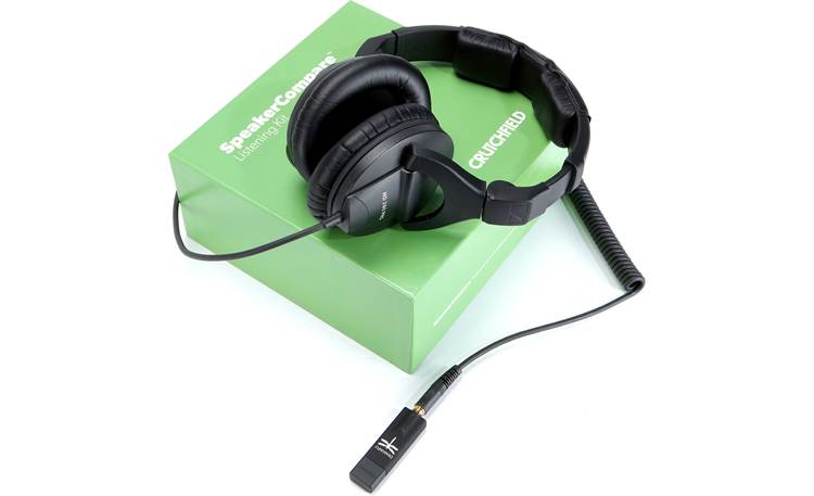
You can also use the Blackbird to store and enjoy your favorite MP3 music files. Just save them to a digital media card (SD or MMC), slide the card in the slot, and you're ready to go. You can even plug a set of headphones into the built-in headphone jack and use the Blackbird as a portable MP3 player.
Alpine built in a rechargeable battery so you can use the Blackbird outside of the car. The package also includes a windshield mount, along with car and home power adapters.
*Currently, NAVTEQ Traffic RDS service is available only in the following cities:
- Annapolis, MD
- Atlanta, GA
- Austin, TX
- Baltimore, MD
- Boston, MA
- Buffalo, NY
- Chicago, IL
- Cincinnati, OH
- Cleveland, OH
- Columbus, OH
- Dallas-Ft. Worth, TX
- Denver-Boulder, CO
- Detroit, MI
- Hartford-New Britain, CT
- Houston-Galveston, TX
- Kansas City, KS-MO
- Las Vegas, NV
- Los Angeles, CA
- Memphis, TN
- Miami-Ft. Lauderdale, FL
- Middlesex-Somerset-Union, NJ
- Milwaukee-Racine, WI
- Minneapolis-St. Paul, MN
- Nassau-Suffolk, NY
- Nashville, TN
- New York, NY
- Norfolk-Virginia Beach, VA
- Orlando, FL
- Philadelphia, PA
- Phoenix, AZ
- Pittsburgh, PA
- Portland, OR
- Providence-Warwick-Pawtucket, RI
- Riverside-San Bernardino, CA
- Sacramento, CA
- St. Louis, MO
- San Antonio, TX
- San Diego, CA
- San Francisco-Oakland, CA
- San Jose, CA
- Seattle-Tacoma, WA
- Tampa-St. Petersburg, FL
- Washington, DC
- West Palm Beach-Boca Raton, FL
Product highlights:
- portable GPS satellite navigation unit
- built-in, fold-up antenna receives satellite signals
- 3.6" color screen with touchscreen controls
- built-in traffic-information receiver compatible with NAVTEQ Traffic RDS real-time traffic information service (subscription required)
- MP3 playback from digital media card (SD or MMC)
- preloaded, detailed maps of the U.S.
- 6 million selectable points of interest (POI)
- POI icons can be overlaid on maps
- programming of up to 10 intermediate points along a route
- three separate map views: map, arrow, and map/arrow list combo
- automatic route recalculation in the event of a missed turn
- address book with up to 100 destinations
- home and car power adapters
- built-in rechargeable battery with 2 hours of life
- windshield mounting bracket
- built-in speaker
- USB cable
- 5-13/16"W x 2-15/16"H x 1-3/16"D
- weight: 8 oz.
- warranty: 1 year
- MFR # PMD-B100T
What's in the box:
Alpine PMD-B100 Blackbird owner's manual
- Portable navigation receiver
- PMD-BAT1 Li-polymer battery (3.7V/1200mAh)
- Cradle with attached 55" cigarette lighter charger and suction cup
- AC adapter with attached 73" cord (Output: 5V/2A)
- 58" USB cable (has a USB Type A connector on one end and a Mini USB Version 2.0 connector on the other end)
- Hard plastic mounting disk with self-adhesive base
- 4 Machine screws
- 1 Cradle eject lockout screw
- 1 Soft carrying case
- 1 Wiping cloth
- Owner's Manual
- Quick Reference Guide
- Customer Care Registration card
- "Software Updates" sheet
- Note on mounting the Blackbird
- 90 Day Free Trial NAVTEQ Traffic RDS brochure
Customer reviews for Alpine PMD-B100 Blackbird
Loading...
Loading reviews...
Average review:
4.0 out of 5 starsThanks for submitting your review
Customer photos


This review was collected as part of a promotion
Pros:
Cons:

More details on the Alpine PMD-B100 Blackbird

Features & specs
| Features | ||
|---|---|---|
| Maps | Built-in | |
| Map Coverage | USA, Canada | |
| Points of Interest | 6000000 | |
| Multiple Destination Routing | --- | |
| Screen Size | 3.6" | |
| Bluetooth Capable | No | |
| Text To Speech | --- | |
| Voice Control | --- | |
| Traffic Information | No | |
| Dynamic Content Services | --- | |
| Removable Memory Type | SD/MMC | |
| Battery Life | N/A | |
| Warranty | ||
| Parts Warranty | 1 Year | |
| Labor Warranty | 1 Year | |
Product Research
Product Overview: The PMD-B100 Blackbird is a portable GPS navigator and digital entertainment system, all in one. Combined with detailed maps, the Blackbird provides automatic routing, turn-by-turn voice directions, and touchscreen control. The unit also includes a built-in traffic receiver (subscription needed). In addition to these navigation features, the Blackbird can play MP3 and WMA files.
SD/MMC Card Slot: The Blackbird can play back MP3 and WMA audio files from an optional SD memory card or MultiMediaCard. The audio player allows you to repeat the songs in the current folder, or play the songs in random order.
Map Software: The Blackbird comes loaded with detailed maps of the United States and Canada. The maps feature approximately 6-million points of interest (POIs), such as hotels, restaurants, gas stations, ATMs and attractions.
Touchscreen Display: The unit features a bright, 3.6" (diagonal) LCD with touchscreen controls. The display has a resolution of 320 x 240 pixels.
Map Display Modes: The main map display contains the following information: current position icon, current street name, next street name, distance to destination, direction to destination, estimated time remaining/estimated time of arrival, distance to next maneuver, next maneuver arrow, map orientation, map scale, and GPS status bar. The Route Mode can be set to one of the following modes:
- Arrow: allows you to switch between the main map display and Arrow Mode, which displays three successive arrow maneuvers all the way to your destination while providing turn-by-turn guidance prompts
- Split: allows you to switch between the main map display and Split Arrow/Map Mode, which displays a large arrow and larger next-street-name font along side a map screen while providing turn-by-turn guidance prompts
Destination Input: The Destination Menu gives you many different ways to choose your destination:
- Address: you can input your destination's address by street and city
- Point of Interest: you can enter a Point of Interest by place name or place type
- Recent Destinations: allows you to choose your destination from a list of recent destinations
- Coordinates: allows you to choose a destination by entering its latitude and longitude
- Address Book: if a location has already been placed into your personal address book, you can recall the location for use as a destination
- Intersection: you can enter the intersection of two streets and make it your destination
- Home: if you have registered a location as "home", you can enter "Home" as your destination
Waypoints: You can set up to 10 waypoints from your current location to the current destination.
POI Icons: The navigation system can display up to 37 different Points of Interest icons around the cursor position when you scroll the map. These include ATMs, banks, gas stations, grocery stores, hotels/motels, parking lots, convenience stores, bed and breakfasts, post offices, hospitals, and restaurants.
Displaying the Entire Route: The navigation system allows you to view the entire route so you can verify if the route calculation is correct.
Route Calculation Method: Depending on the time of day, you may want to alter the way the system calculates the route. You can choose from the following route calculation methods:
- Quickest: calculates the most efficient way to arrive at your destination
- Shortest: calculates the shortest route to your destination
- Maximize Freeways: calculates a route that makes most efficient use of freeways
- Minimize Freeways: calculates a route that uses mostly surface streets
- With/Without Toll Roads: calculates a route with or without toll roads
- With/Without Ferry: when calculating a route, you can set whether to use a ferry or not
Off-route Recalculation: If you deviate from the suggested route, the system can recalculate a route to get you back on the way to your destination.
Detour Function: If during a route you require the system to detour around an obstacle, you may use the Detour button to automatically recalculate a new route.
Trail Feature: The Trail feature allows you to turn on and off trail dots that appear wherever the vehicle icon traverses. This is especially helpful for off-road enthusiasts.
Simulating Navigation: When indoors, you can activate the built-in simulator and practice using the unit. This turns off the GPS receiver so it's not searching for satellites.
Trip Information: The Blackbird keeps track of the following trip information:
- Driving Average: average speed since Trip Info was reset
- Overall Average: average speed since start of trip
- Maximum Speed: maximum speed reached on current trip
- Driving Time: time vehicle has been moving since the trip was reset
- Idle Time: time vehicle has been stopped since the trip was reset
- Total Time: total elapsed time on the trip, which is always the driving time plus idle time
GPS Status: You can view the dynamic location information received from satellite such as signal strength, compass (direction information), latitude/longitude, approximate altitude, and speed.
Map Screen Orientation: You can select one of the following map screen orientations:
- North Up: the map display is positioned so that north is always at the top of the screen. The Present Vehicle Position icon will rotate on the map.
- Heading Up: the Present Vehicle Position icon can be positioned so that its current direction is always pointing to the top of the screen. In this case, the icon remains frozen in the center of the display while the map rotates with each turn.
Estimated Time Display: When the system calculates a route, it also estimates the time it will take to arrive at the destination. It will display this estimate as the arrival time, or the time remaining to reach the destination.
Screen Color Mode: You can select one of three color modes for the display screen:
- Day: has a lighter, brighter background
- Night: has a darker background and is easier to see at night
- Auto: display automatically switches between Day and Night at sunrise and sunset
FM Transmitter: When the built-in FM transmitter is active, it broadcasts music and voice prompts to an available frequency on your FM car radio. The FM transmitter can be set to one of the following frequencies: 88.1, 88.3, 88.5, 88.7, 88.9, 106.7, 106.9, 107.1, 107.3, 107.5, 107.7, or 107.9 MHz.
Built-In Traffic Receiver: The Blackbird feature a built-in traffic receiver that supports the optional NAVTEQ Traffic RDS service with a subscription which displays real roadway information in real time from multiple sources on the Blackbird's screen. NAVTEQ Traffic RDS includes traffic information from top local sources, including police, video cameras and departments of transportation. This information is continuously updated, processed and delivered wirelessly, instantly to the Alpine Blackbird. NAVTEQ Traffic RDS even features color-coded roadways to illustrate the average speed of traffic for the road you are traveling and unique icons to indicate accidents, stalled vehicles, road construction and road closures. The Alpine Blackbird can use this traffic information to create a smarter and quicker route to your destination. NAVTEQ Traffic RDS map coverage currently covers 42 major cities in the United States and is still growing. Visit www.BlackbirdTraffic.com for up-to-date market coverage.
Note: Currently the Blackbird comes with a Free 90 day trial of NAVTEQ Traffic RDS right out of the box. Upon conclusion of the 90 day trial period, the NAVTEC Traffic RDS service is available through NAVTEQ for a standard annual fee of $60.00. The Traffic feature is only available when the Blackbird is placed in the cradle or optional docking station.
Optional Wireless Remote Control: The Blackbird can be controlled by the optional Alpine RUE-4140 wireless remote.
Optional Docking Station: The optional PMD-DOK1 docking station allows you to connect the Blackbird to a compatible Alpine Multimedia Station or stand-alone display.
Power Requirements: The Blackbird operates on your vehicle's battery using the included 12-volt cigarette lighter power adapter, the Lithium-polymer battery, or household current using the supplied AC adapter. Stored data, such as waypoints or unit settings, are not lost when the unit is disconnected from a power source.
Antenna: The built-in antenna is located in the unit's back panel and must be flipped up during navigation. An optional external antenna (PMD-ANT1) may be needed when operating the unit with a coated windshield or an in-screen heating system, which can block the GPS signal. The unit has an external GPS antenna jack with an MCX-type connector.
Mounting Options: The unit should be securely installed when used in a vehicle. The unit comes with a mounting cradle that includes a suction cup. The suction cup can be used to mount the unit to the windshield or to the dash (using the plastic mounting disk). Once the Blackbird is mounted, it can be adjusted for best visibility.
Note: If you're not using a remote antenna, the unit must be installed where it has a relatively unobstructed view of the sky.
Pro.Fit Bracket Compatibility: The Blackbird is compatible with the Pro.Fit Legend series Vehicle Specific Mounts (VSM). The Blackbird can also be used with the regular Pro.Fit VSMs when combined with the EZ-1026 easy swivel adapter.
Interface Capability: This unit can be connected to a PC via the supplied USB cable. This interface allows you to download additional map information to the unit's memory.
Top Panel of Blackbird:
- Headphones: minijack headphone output
Bottom Panel of Blackbird:
- USB: USB Mini-B Type 2.0 that allows you to connect the Blackbird to a computer using the supplied USB cable
- Antenna: MCX-type connector that allows you to connect an optional external GPS antenna (PMD-ANT1)
- Cradle Connector: proprietary port that interfaces with the supplied cradle and allows you to connect the supplied AC power adapter
Back Panel of Cradle:
- Antenna: SMA-type connector that allows you to connect an optional external GPS antenna (PMD-ANT1)
Loading...
Loading accessories...
Customer Q&A
Loading...
Loading articles...